Transforming Latitude-Longitude Data |
||||
Home |
||||
The ll2cmap program is used to convert a global latitude-longitude HYSPLIT formatted meteorology file to an HYSPLIT formatted file on a conformal map projection, either Polar Stereographic, Mercator, or Lambert Conformal. The converted file will be a geographic extract of the orginal, containing the minimum number of variables required to run HYSPLIT. Additional variables may be added to the output as a command line argument. The vertical coordinate of the output data will be unchanged unless the pressure to sigma interpolation option is selected, available only for pressure level input data. The remapping uses bilinear interpolation of the meteorology variables unless the nearest neighbor option is selected.
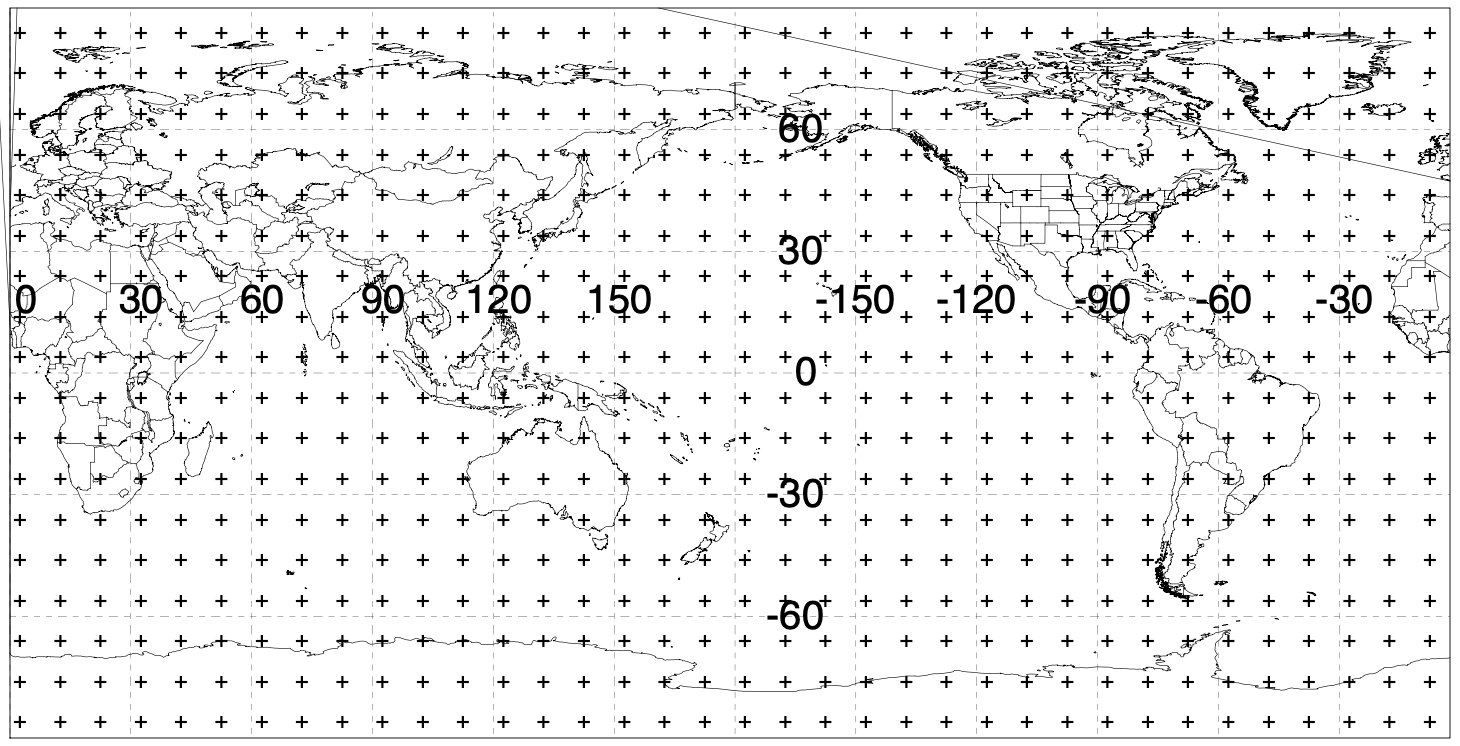
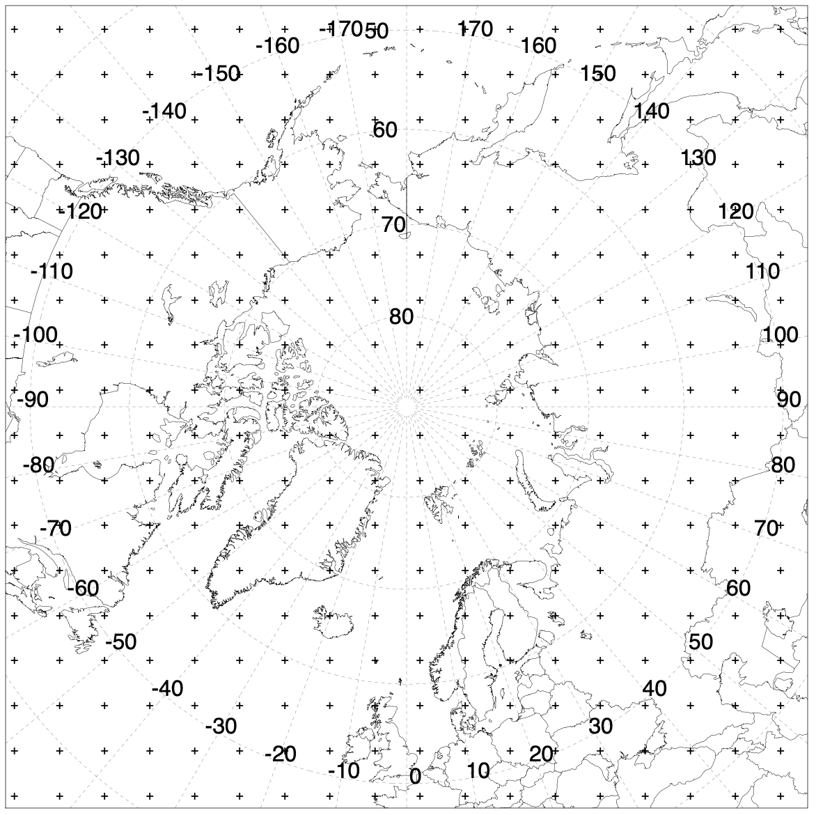
| Global Latitude-Longitude | North Polar Stereographic |
 |
 |
USAGE: ll2cmap -[options (default)]
- -a[Analyze input file]
When set no output file is produced, but the diagnostic output is turned on.
- -d[Diagnostic output turned on]
When set detailed information about the structure and contents of the input and output files are printed to standard output.
- -i[Input file name]
Enter the complete name of the HYSPLIT formatted meteorological data input file. The input data must be on a global latitude-longitude grid.
- -o[Output file name]
The name of the output file. If the file exists, it will be deleted prior to opening for output. Because all HYSPLIT formatted meteorological data files are read and written using direct access, if the new file is smaller than the original, unwanted data records may remain in the new file. Therefore, all existing files are deleted first.
- -c[Center latitude:longitude of the output grid (40.0:-90.0)]
The latitude and longitude of the center of the conformal output map. The latitude also determines the type of conformal projection when the default map projection type (-m) remains as Auto. Latitudes greater than 60 result in Polar Stereographic maps, while latitudes less than 30 result in Mercator maps. Between 30 and 60, Lambert maps are created.
- -g[Grid resolution in km (default same as the input file)]
The resolution of the output grid defaults to the approximate latitudinal resolution of the input grid. The grid resolution values can be displayed using the analysis (-a) or diagnostic options (-d).
- -n[Number of grid points in latitude:longitude (25:25)]
With only one entry, a square map is produced such that the number of latitude and longitude grid points are equal. A colon would separate the two entries. Note that the product of the grid resolution and the number of grid points determines the size of the map.
- -m[Map projection (A)uto | {P}olar | {L}ambert | {M}ercator]
When the default is Auto, the map projection type is determined by the map center latitude (-c). Regardless of the latitude setting, a map projection can be forced using this setting. However, there are no safeguards, and it is possible set conflicting map options.
- -p[Process for remapping {N}eighbor | (I)nterpolation]
The default option is to use bilinear interpolation to map all variables to the output grid. Under certain circumstances it may be desirable to use the nearest neighbor approach to preserve the spatial structure of the input data without the smoothing effects of interpolation. However, the nearest neighbor approach should be avoided when the output grid resolution is much times smaller than the input grid resolution, as too many grid points will have the same value.
- -v[Vertical coordinate for output (I)nput | {S}igma]
The default option is for no transformation of the vertical coordinate system. That is whatever vertical coordinate is used for the input data (-vI) is also used for the output data. However, if the input data are given on an absolute pressure coordinate system, then one can transform the output data to a pressure-sigma (-vS) coordinate system σ = (P-Pt)/(Ps-Pt), where Ps is the surface pressure, Pt, is the pressure at the model top, and P is the pressure at the σ level. If using HYSPLIT with the meteorological data, the σ transformation is not necessary, as HYSPLIT does its own vertical coordinate remapping. If the output domain is centered over a higher terrain region, the transformation may be desirable to further reduce file sizes by eliminating below ground data levels.
- -s[Surface variable to add e.g. PRSS; one varaiable for each -s]
The program will only select from the variables from the input file that are on its internal list [PRSS SHGT PBLH TPP6 RH2M U10M V10M T02M UMOF VMOF SHTF] to output. If the input file contains additional variables that are desired, then a command line entry is needed for each variable to be added: -sVAR1 -sVAR2.
- -u[Upper level variable to add e.g. HGTS; one variable for each -u]
The program will only select the variables from the input file that are on its internal list [HGTS PRES TEMP UWND VWND WWND RELH] to output. If the input file contains additional variables that are desired, then a command line entry is required for each variable to be added: -uVAR1 -uVAR2. Note that DIFF variables cannot be processed by this program at this time.
This program can be used to remap the HYSPLIT compatible global latitude-longitude meteorological data files found on the NOAA-ARL FTP server. A detailed description of the global latitude-longitude meteorological data files is given for the forecast and the archival data.
The ll2cmap program is not part of the HYSPLIT distribution, but the source code and executables for a few operating systems are available for download.
As an example, to convert the weekly global one-degree resolution GDAS archive file to a 50 km resolution 90 by 90 grid point polar stereographic projection, named polar_file.bin, centered over the North Pole and Greenwich meridian, the following arguments would be used: